
")
")
The General Staff of Cuba's Civil Defense (DC) issued a hurricane warning for Pinar del Río, Artemisa, and the Isla de la Juventud special municipality, due to the proximity of Tropical Storm Idalia.
Havana, Cuba.- The CD’s press release number 2 explains that the western provinces of Mayabeque and Havana also remain in the informative phase.
According to a statement issued at 10:00 a.m., local time, the measure was adopted due to the deterioration of weather conditions in the western region, with particular emphasis on the aforementioned provinces.
The institutes of Meteorology and Hydraulic Resources, together with the DC General Staff are watching this weather phenomenon closely, the DC reported.
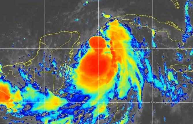
According to information from the Forecast Center of the Institute of Meteorology, over the past few hoursTropical Storm Idalia has maintained a northerly course, increasing its speed to 13 kilometers per hour. Its maximum sustained winds are 60 miles per hour with higher gusts, and its minimum central pressure is 990 hectopascals and could become a hurricane later this Monday.
At noon today, its center was located at 21.0 degrees north latitude and 85.2 degrees west longitude, 100 kilometers south-southwest of Cabo de San Antonio in the province of Pinar del Río.
Over the next 12 to 24 hours, Idalia will continue to move northward, gaining organization and intensity, and could become a hurricane this afternoon as it crosses the northwestern Caribbean and approaches Cabo de San Antonio, Pinar del Río province.
The rainy areas over the western region have been gradually increasing since this morning, especially in Pinar del Río and the special municipality of Isla de la Juventud; in addition, rains have begun in Artemisa and Havana. The probability of rains remains high over much of the country, especially in the western half, where they could be strong and intense in some places. (PL)