
")
")
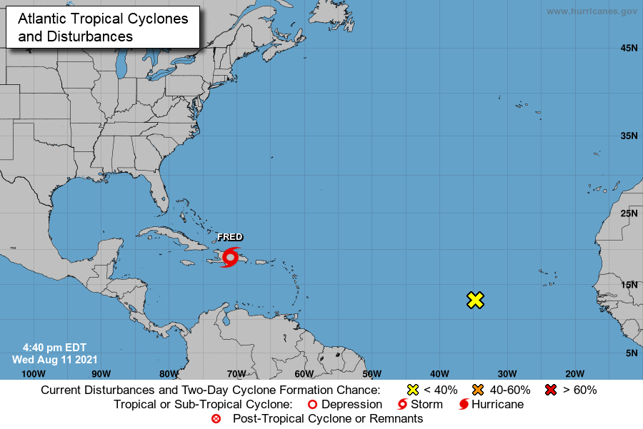
Since 12:00 noon this Wednesday, the province of Las Tunas is in the Informational Phase, as established by the National Civil Defense Staff, due to the probable passage through the seas north of Cuba of Tropical Storm Fred. In a similar status are the other provinces of eastern Cuba, along with Camagüey and Ciego de Ávila. "The rest of the provinces must remain vigilant," the Civil Defense said.
Las Tunas, Cuba.- "Fred" was formed on Tuesday night and, according to the experts of the Forecasting Center of the Institute of Meteorology, during this August 11, it will move next to the west-northwest. In its way, it will transit this Wednesday over the island of Hispaniola, emerging again at sea at the end of tonight or the early hours of the morning, gradually approaching the eastern region of Cuba.
“Tropical Storm Fred is forecast, they said, to experience some weakening due to its interaction with mountainous land. Once it emerges back into the sea, it may go through a very slight intensification, due to strong currents in the upper air that will prevent its rapid strengthening.”